30-31
Grimsel Pass to Lauteraarsattel and Unders Studerjoch
The mountains described in this section are
of relatively modest
altitude and can provide good climbing when
their more illustrious
neighbours are ruled out by climatic
conditions. The most
important and best known peak is the Wetterhorn whose ascent by
Alfred Wills in 1854 was a major milestone in
the history of
mountaineermg.
Most of the peaks have
fine rocky ridges with steep faces
between. In a few cases the faces provide
good snow and ice routes.
Long glaciers traverse the area and provide
the approach to many of
the routes described. It is a good place for
the alpine novice and is
usually far from crowded.
In and around the Grimsel
Pass there is to be found some
superb rock-climbing on perfect granite. Not
far away in the
Engelharner the same can be said, except that
here the rock is
limestone. The climbing in both areas is
comparable in quality with
just about anything found elsewhere in
Europe. A good selection of
these climbs is described in this guidebook
in the rock-climbing
section.
Maps covering this section are: Nufenenpass
(265), Sustenpass
(255) and Interlaken (254)
Wasenhorn 3446.8m
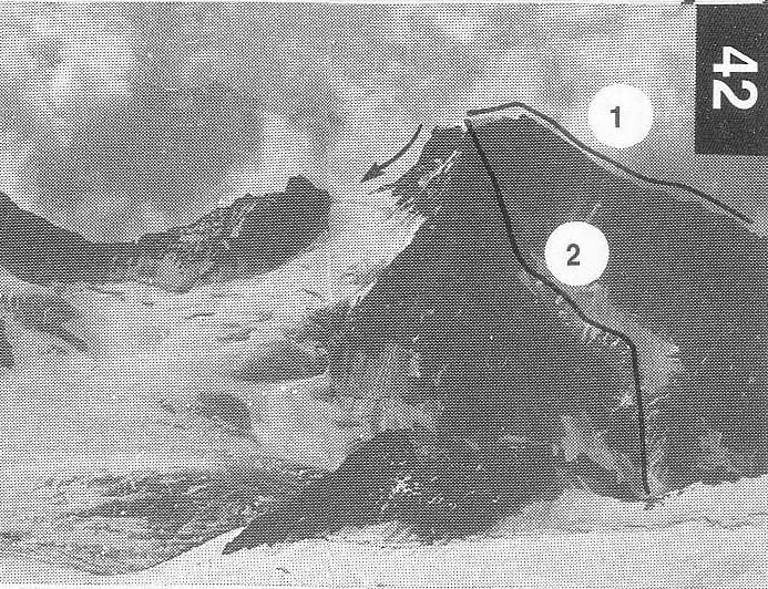
B and Frau Tauscher with A Pinggera and J
Reinstadler,
14 Aug 1885
The mountain has three ridges one of which,
the W, bifurcates in its
lower part. In years of normal snow cover the NW face makes an
interesting climb.
PD From the
42 glacier to the foot of the rocky
promontary called Rotioch
(2843.3m). Cross the Galmi glacier Swards and climb up
mixed
grass and rock into the coombe between the
two branches of the
W ridge. Get onto the S branch via an easy rock couloir and follow
the ridge to the summit. Shr
The climb can be made from the Oberaarjoch
hut by
following Route H9 (alternative) to the
junction between the Galmi
and Fiescher glaciers. The time is the same.
The route can be reversed, or the descent can
be made by
following the NE ridge (first ascent party) to the col at 3141m. F+
D M Brandt, A and R
Voillat,
42 The face is about 550m high and mostly
glacier. In recent years this has
shrunk, but should normal snow cover return,
the face will provide a
good climb.
From the Oberaarjoch hut climb down to the col then descend SSW
across the Studer and Galmi glaciers to the bergschrund at about
2900m. Climb up to the R side of the s £rac zone via a
steep and icy
couloir (100m), then cross the easier slopes
to a second bergschrund
below and L of some rocks which protrude from
the steeper summit
slopes. Climb the icy slope (530) to a rock
rib which leads to the top,
a little to the NE of the summit. 5-6hr
It is almost as easy but a little longer to
start at the
the face.
30-31