114-115
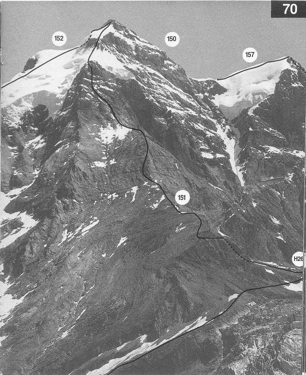
151 INNER ROTTAL
RIDGE (
AD F von Allmen with U Brunner, F Graf inr, K Schlunegger and
70 J
Stager,
The route follows the S branch of the SW ridge. It is a splendid long
climb and the only satisfactory route on the W flank of the mountain. It is
quite delicate if the rock is snow-covered or verglassed and the best line is
not easy to find, especially in descent.
From the Rottalhut follow a track NW to the foot of the crags seen
on the skyline above the hut. Climb through these easily by moving
La little way and reach the broad and fairly level part of the Inner
Rottal ridge (cairn at Pt 2927m).
Go along the ridge to a steepening then slant L (but not too
far) and climb easy slabs to regain the crest of the ridge, above the
steep section, at a narrow, smooth rock nose in which there are
three iron stakes. It is possible to move well to the L at the
steepening and climb slabs and gullies to regain the ridge, but this
will always be harder than the route described. Above the nose
continue to a snow saddle where the main difficulties begin.
Move L off the ridge and climb a couloir slanting L (two fixed
ropes). Slant back R at the top of the couloir to a steep wall (gneiss
now after limestone) and climb the wall (fixed rope) to easier ground
leading up to the ridge on the L, which is gained close to Pt 3790m.
Difficulties in this section are II and IIL At this point Inner and
Outer Rottal ridges merge.
Continue up the ridge and climb a steep section, via a shallow
snow couloir and easy rock steps, to the upper snow plateau from
which a steep snow slope and easy rocks lead to the summit. You
can avoid the steep section by keeping L and traversing back R onto
the snow plateau. 6-8hr

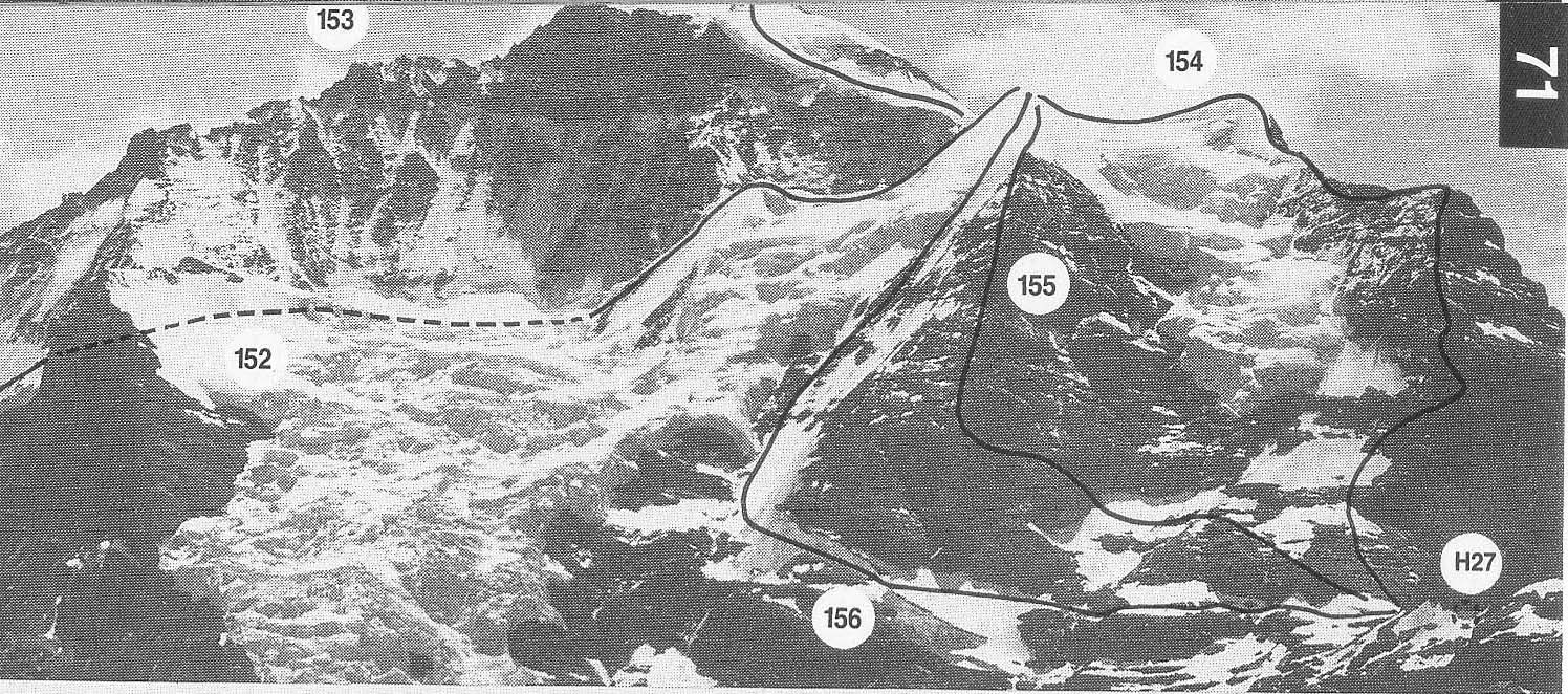
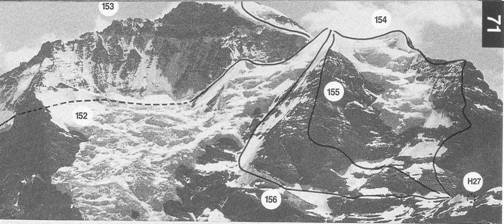
152 GUGGIROUTE (
D H George and G Young with C Almer, U Almer sur and
71 H
Baumann,
At one time quite frequently climbed, but glacier conditions have changed
over the years and it is now a considerable undertaking, whilst remaining
a very fine climb in magnificent surroundings. The main difficulties are
on ice, but the ability to navigate quickly through jumbled glacier terrain
is important. Late in the season the route is probably impracticable. See
also photos 70 and 80
From the Guggi hut descend a couloir down ledges and slabs
(unpleasant, cables) SW. Stillon the rocks traverse S, rising slightly
(more cables) to some polished rocks. Turn these and then descend
to the Guggi glacier (more cables) at a flat area with few crevasses.
Climb the glacier SW to the icefall below the Chielouwenen glacier.
Climb the icefall (often complex and difficult) to the snow basin
above. Cross this W wards to the rocks at the foot of the
Schneehorn. Climb these direct or slanting up from L to R to a
snowy ledge. Either gain the summit or avoid it on the L and enter
the upper coombe of the
Cross the coombe SW to the foot of the Kl Silberhorn
(3543m). Climb the snowlice ridge to its summit and so reach the
snow coombe below the Silberliicke. Cross the coombe in the
direction of the col (bivouac site) and climb to it by a steep snow
slope. The slope may be icy or protected by a large bergschrund. In
this case continue up the NE ridge of the Silberhorn (3695m) and
descend the easy, rocky S ridge to the col.
Climb a short rock ridge and an exposed snow crest to the
Hochfirn and then continue up this to the summit rocks which are
climbed via a steep snow slope and easy rocks. 8-12 hr
114-115